Maunalua, O‘ahu
Meaning of Maunalua
Maunalua, the traditional name for the area now known as Hawai‘i Kai, literally means two mountains in reference to Kohelepelepe (Koko Crater) and Kuamo‘okāne (Koko Head), that prominently peaks on the east side of O‘ahu. Numerous small valleys are contained within, and a Keahupua o Maunalua (Kuapā Fishpond) is also located on the coastline in the western portion of this ahupua‘a.
Location
The land of Maunalua was formerly an ‘ili (subdivision) of the Waimanalo ahupua‘a and originally belonged to Ko‘olaupoko district. In 1859, Maunalua was included in the Kona district with the Revised Laws of Hawai‘i 1925, setting the district boundaries from Makapu‘u Head to Moanalua inclusive. Kamehameha Schools landholdings in Maunalua encompass 2,810-acres of preservation land, 116-acres of agriculture and 82-acres of commercial.
Encompassing Lands and Mo‘olelo ‘Āina
Kohelepelepe (Koko Crater) refers to the flying vagina in the mo‘olelo of Kamapua‘a. When Kamapua‘a was battling Pele, Kapo, Pele’s sister sent her “flying vagina” as far as Maunalua on O‘ahu. It is said that the Makapu‘u side of the volcanic feature resembles her vagina and now the mountainside is remembered by the name Kohelepelepe, literally translating into the “flying vagina.”
Kuamo‘okane (Koko Head) is located at the eastern rim of Maunalua Bay and the hill above Hanauma Bay. Kuamo‘okane was called “Mo‘okua o Kāne‘apua,” which means “the backbone of Kāne‘apua.” Kāne‘apua, the younger brother of Hawaiian akua, Kāne and Kanaloa, was left there by his brothers because he was slow to return with fresh water from a spring on the hill. Kāne‘apua threw himself face-down to the ground and his body remains there as Kuaomo‘okāne.
Hanauma Bay has been recalled being named after the Hawaiian game of umauma. This game is similar to the modern-day game of arm wrestling, except the players were in the kneeling or prone position. Another definition gives the literal translation of this place as meaning “curved bay.” Traditionally, this bay was used as a place of fun and games. Today, the bay’s main purpose is a nature preserve reserved for snorkeling activities within its reefs.
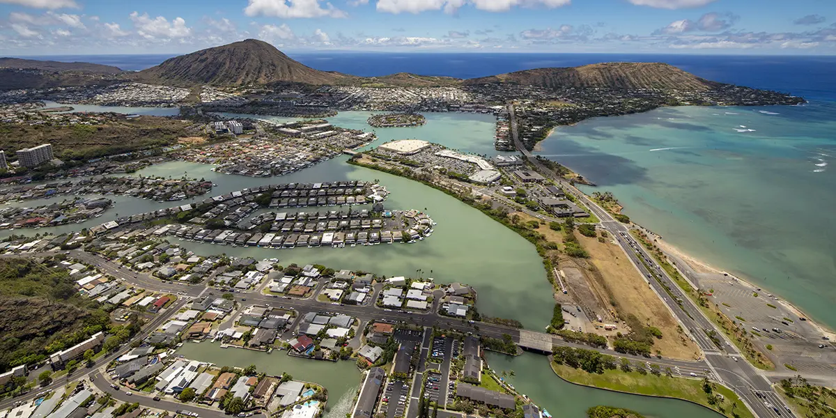
Keahupua O Maunalua (Kuapā Fishpond) was located in the vicinity of the present-day Koko Marina. The fishpond was a former bay until the Hawaiians built a mile-long wall at the mouth of the bay. It encompassed an area of 523 acres. Legend has it that an underground tunnel connected Kuapā fishpond with Ka‘elepulu fishpond in Kailua.
Natural Resources
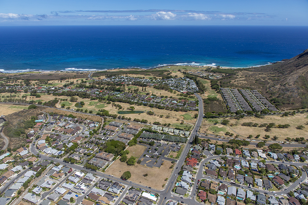
The Maunalua and Hahaʻione districts were famous for their sweet potato cultivation. Undeveloped areas mauka and makai include significant cultural and natural resources such as watershed management areas, Hāwea heiau, and the Keawāwa wetlands.
Pre-Historical Land Use
According to the last surviving kama‘āina of Maunalua, sweet potatoes were grown in the small valleys, such as Kamilonui, as well on the coastal plain. The plain below Kamiloiki and Kealakipapa was known as Ke Kula o Kamauwai. This was the famous potato-planting place from which came the potatoes traded to ships that anchored off Haha‘ione in whaling days. The village at this place, traces of which may still be seen, was called Awāwāmalu.
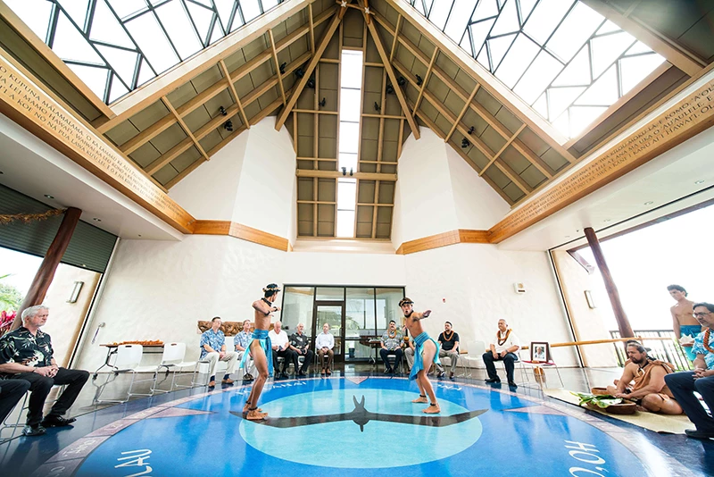
Kamehameha Schools has been entrusted with the stewardship of Maunalua upon Princess Bernice Pauahi Bishop’s passing in 1884 and is fully committed to the community of people who live, create, work, and play in this ahupua‘a.
Māhele ‘Āina
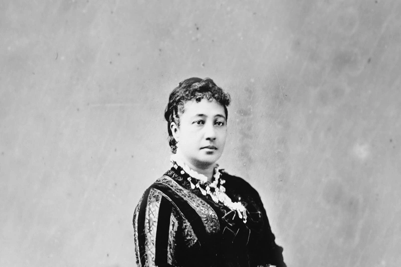
The ahupua‘a of Maunalua was granted to Victoria Kamāmalu in the Māhele of 1848 within Land Commission Award 7713. The lands eventually were inherited by Princess Bernice Pauahi Bishop and today owned and managed by Kamehameha Schools.
In 1928, Kamehameha Schools granted the lands of Koko Head, Haunama Bay and Koko Crater to the City and County of Honolulu for one dollar. The lands were granted to the C&C of Honolulu on the stipulation that it be used as a city park and rights of way. Although the lands are no longer in the Kamehameha portfolio of lands, it still can be traced as part of our lineage of lands inherited by the Kamehameha Schools with many chiefly ties.

Victoria Kamāmalu
Historical Land Use
In 1888, Charles Reed Bishop, the husband of Ke Ali‘i Bernice Pauahi Pakī Bishop, entered into a 10-year lease agreement with S.M. Damon and G. J. Campbell for land in Maunalua. However, fisheries and fishponds on the property were reserved. Damon, a Trustee of Bishop Estate, utilized the land for cattle ranching during this period.
By 1900, Maunalua saw a transition as Maunalua Ranch and Yit Lee Company leased the area. Under their management, 1,500 head of cattle were raised, and the operations involved the employment of ten Chinese families. Maunalua Ranch continued its ranching activities until 1926.
In 1927, Kamehameha Schools sold the RCA buildings in Maunalua to Lunalilo Estate to construct Lunalilo Home. The following year, in 1932, additional lands were leased to Alan Davis for various purposes, including grazing, honey production, and charcoal companies.
The landscape of Maunalua underwent significant changes in subsequent decades. In 1958, the Koko Head area became a hub for farming activities, with 178 families engaged in producing 60% of the hogs, flowers, and Manoa lettuce grown on O‘ahu. In 1961, a pivotal moment occurred when Henry J. Kaiser secured a long-term land lease with Bishop Estate, leading to the development of Koko Marina Center in 1963 and Hawai‘i Kai Shopping Center in 1969.
The 1970s marked the establishment of the Kamehameha Schools Agricultural Leasing Program with Kamilonui and Lunalilo Ag Lots. Additionally, in 1974, the Hawai‘i Kai Golf Course was developed. Subsequent years witnessed further growth and modernization, with the Hawai‘i Kai Towne Center being developed in 1982, shaping the evolving history and timeline of Maunalua.
‘Āina Pauahi ma Maunalua Planning
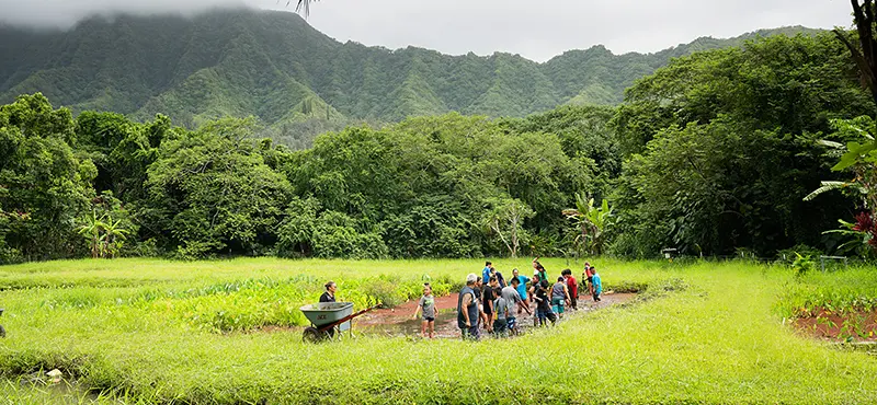
Kamehameha Schools has initiated the early stages of outreach, actively engaging the community to collect valuable insights that will inform the development of a comprehensive plan for the future management of preservation, agriculture, and commercial lands in Maunalua. For more information, please visit the Maunalua Planning page.